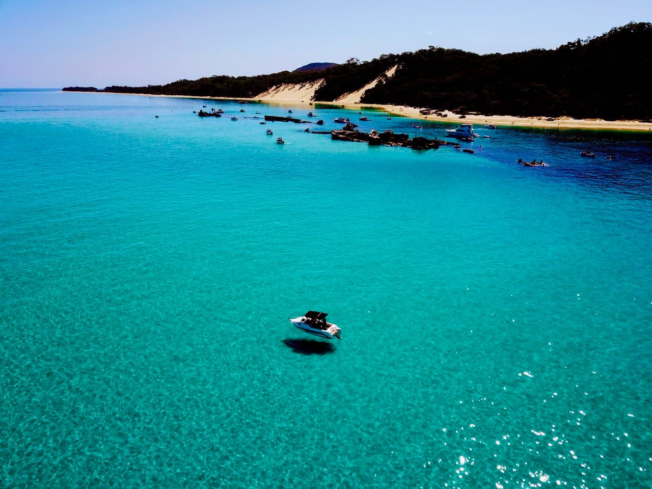
Tangalooma is on the western side of Moreton Island (Mulgumpin), about 40 km north-east of Brisbane, one to two hours from a mainland ramp in good weather, depending on what you are driving. What makes it unlike anywhere else in the bay is the combination: one of Australia's best snorkelling sites sitting a few metres off a protected anchorage, with a national park behind it.
The Tangalooma Wrecks are fifteen vessels deliberately sunk between 1963 and 1984 to make a safe harbour for small boats. They now hold over two hundred species of fish, coral, and regular visits from dolphins, dugongs and turtles. They lie in 2 to 12 metres, which is shallow enough that snorkelling is the right tool rather than a compromise.
Tangalooma Island Resort is next door and sells day passes to boaters who want the facilities, the restaurants, and the wild dolphin feeding that happens on the beach each evening at sunset.
Getting there
Launch from Manly Boat Harbour (four lanes, Coast Guard next door), Wynnum Creek (two lanes, better for smaller boats), or the Port of Brisbane ramp (two lanes with a pontoon). Head north-east across the bay toward Tangalooma Point on Moreton Island's western shore. The wrecks are visible out of the water between Cowan Cowan Point and Tangalooma Point, so the last part of the navigation does itself.
You will cross the Brisbane shipping lanes. Ships have right of way and cannot alter course for you in any meaningful sense. Give them a wide berth, and never anchor in a shipping channel.
| Waypoint | Position | |
|---|---|---|
| A | Manly Boat Harbour | -27.452000, 153.185000 |
| B | Wynnum Creek ramp | -27.437500, 153.163000 |
| C | Port of Brisbane ramp | -27.369000, 153.169000 |
| D | Brisbane shipping lanes | Exercise extreme caution |
| E | Tangalooma Wrecks | -27.163202, 153.368669 |
| F | Tangalooma Resort jetty | Adjacent to the wrecks |
| G | The Wrecks campground | Walk north from the resort |
| H | Bulwer - fuel in containers | 5 nm north of the wrecks |
Where to anchor
The wrecks give good protection in most conditions. Anchor in the bay behind them, first come first served, so come mid-week if you want a choice, because weekends fill. Strong currents run between the wrecks and the beach at the tide changes, which is the detail that catches out swimmers more than boats.
Safety
Moreton Bay builds a short, steep chop quickly when the wind opposes the tide, and that can double your fuel burn. Plan for it. The closest on-water fuel is Scarborough Marina, 14 nm west.
- Monitor shipping movements in the Brisbane shipping lanes at all times
- Strong currents between the wrecks and the beach at tide changes
- Unpatrolled beach, no lifesavers
- Watch for inexperienced boats and jet skis
- Go-slow zones throughout the bay: turtles and dugongs are present
Access to Tangalooma is through partially smooth water limits, so make sure your safety equipment meets the requirement for it. Joining Marine Rescue Queensland is worth the membership.
Things to do
Snorkelling the wrecks
The main event: fifteen vessels in 2–12 m, coral-covered and full of fish. Best visibility at high tide. Equipment hire at the resort. Strong swimmers can reach them from the beach, but mind the current.
Wild dolphin feeding
Wild bottlenose dolphins come to the resort beach each evening at sunset. Day visitors can buy a pass and hand-feed under Eco Ranger supervision. Booking is essential.
Fishing
Good fishing around the wrecks: snapper, bream, whiting, trevally, kingfish and yellowtail. Fishing is prohibited in the dolphin feeding area and from the resort jetty. Give anchored boats room.
Sand adventures and 4WD
The Desert, an inland sand blow, gives sand tobogganing at up to 40 km/h. 4WD tours run from the resort. Moreton Island is 98% national park with tracks to Blue Lagoon, the Champagne Pools and Cape Moreton lighthouse. Vehicle permits required.
Whale watching, June to October
Humpbacks migrate past the island through winter. Daily cruises run from the resort with a sighting guarantee, and the whales often come closer to the boats than you expect.
Camping at The Wrecks
The Wrecks campground is walking distance from Tangalooma, which makes it the obvious one for boaters. Twenty-one sites in a sheltered bay, walk-in only, no vehicles. There is water (treat it before drinking), toilets, cold showers and bins. No fires and no generators.
Beach camping zones are available along the western beaches with 4WD or boat access. Fires are permitted in existing pits, generators between 8 a.m. and 7 p.m. Permits through Mulgumpin Camping, and book early for peak periods.
The shipwrecks
A short walk north of the resort, the Tangalooma Wrecks are human-made marine engineering that the ocean has since taken over. Beginning in the 1960s, fifteen vessels were scuttled across two decades to form a breakwall giving small boats safe anchorage in the bay. Those hulks are now colonised by coral, home to schools of tropical fish, and visited by turtles, wobbegong sharks, dolphins and dugongs.
Today they are a premier snorkelling and diving site, valued for shallow depth, roughly 2 to 12 m, and good visibility, which puts them within reach of beginners and experienced divers alike. Seen from a glass-bottom kayak or from in the water, the contrast of sun-bleached wreckage against blooming marine life is both haunting and vivid: an undersea playground made half by fate and half by design.
Exact scuttling dates for individual vessels are not readily available, but they went down in batches: five in the 1960s, five in the 1970s, and five in the 1980s.
| The fifteen | |
|---|---|
| UKI | Echeneis |
| Bream | Remora |
| Seal | Platypus II |
| Dolphin | Pelican |
| Morwong | Groper |
| Kookaburra | Stingaree |
| Bermagui | |
| Maryborough | |
| Iceberg |