Boat ramps

Every public ramp we have checked, with lanes, trailer parking and the tide you need to get off it.

142 on the map. See them all at once.
Airlie Beach, Abell Point Marina

Airlie Beach

Airlie Beach, Abell Point Marina

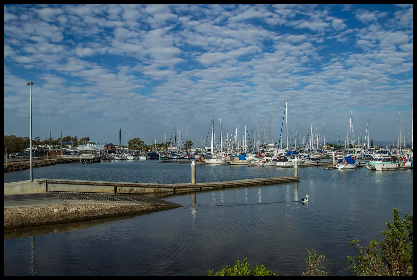
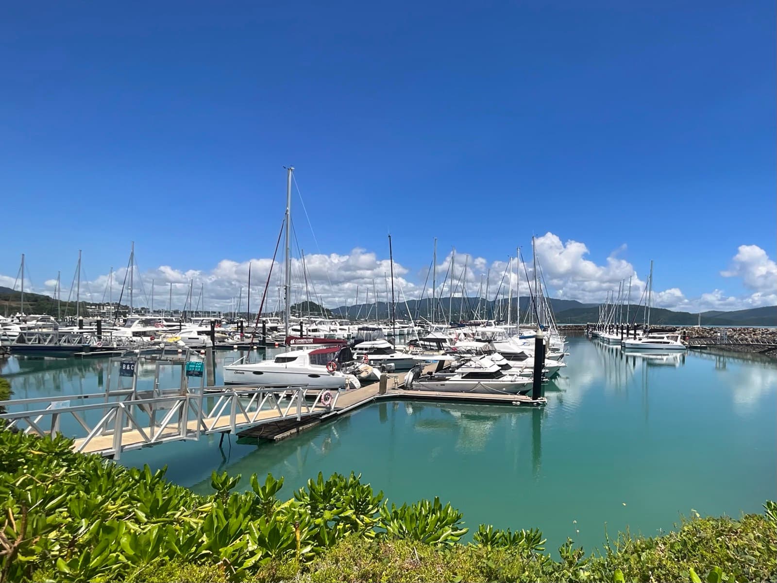
The sheltered launch for Airlie Beach – two lanes and a pontoon tucked in behind the Coral Sea Marina breakwater, with the Whitsunday Islands an easy run offshore. Public ramp, but the car park fills early on any fine weekend.

Airlie Beach

Airlie Beach, Port of Airlie

The town ramp at the eastern end of Airlie Beach – two lanes and a pontoon inside the Port of Airlie marina basin, with the biggest trailer car park of the three Airlie ramps.

Alberton, Alberton Road

Mainland

Alberton, Alberton Road

A wide single ramp with a floating pontoon on the south bank of the Logan River at Alberton – secluded, with toilets, water and 17 bays, and room to drive around with a big rig. The quiet way onto the lower Logan and the southern bay.

Albion, Beaumont Street

Mainland

Albion, Beaumont Street

The Breakfast Creek ramp at Albion – a single lane with a pontoon on the north bank of the creek near its mouth, a tap, seven bays, and the Brisbane River a few hundred metres away. Tide-limited in the creek.

North Stradbroke Island

Amity Point, Claytons Road

The Amity Point ramp on Claytons Road – two lanes with a pontoon and jetty beside Catarita Park, with toilets and picnic tables, unformed parking, and the Rainbow Channel tide running hard past the point.

Mackay

Andergrove, Apsley Way

The McCready's Creek ramp in Mackay's northern suburbs – a single lane with 15 bays, tide-limited, and lit and camera-watched since 2022.

Mainland

Bald Hills, Barungwarra Reserve

A single lane into the South Pine River at Barungwarra Bushland Reserve, Bald Hills – unmarked parking for about 16, no facilities, and an eight-tonne load limit. A quiet bushland launch on the upper Pine.

Bald Hills, Wyampa Road

Mainland

Bald Hills, Wyampa Road

Deep Water Bend at Tinchi Tamba Wetlands Reserve, Bald Hills – two lanes with a pontoon and floating walkway on the Pine River, toilets, water, 55 bays, and picnic areas and a playground in the reserve. The main launch for the Pine and Bramble Bay.

Mainland

Beachmere, Saint Smith Road

Beachmere's Saint Smith Road ramps on the Caboolture River – two lanes and a floating walkway at the upstream ramp, toilets, water and 28 shared bays, with the downstream ramp rebuilt by Maritime Safety Queensland in early 2026.

Bribie Island

Bellara, Marine Parade (North & South)

Sylvan Beach at Bellara – Bribie Island's main ramp, four lanes with a floating walkway on the Pumicestone Passage just north of the bridge, toilets and water, and 106 shared bays. Rebuilt with its car park under the Bellara foreshore renewal.

Mainland

Bethania, Federation Drive

A single lane on the south bank of the Logan at Federation Drive, Bethania – four parks, a water tap, no toilets. A quiet upriver launch for tinnies and kayaks on the freshwater-influenced reach.

Bribie Island

Bongaree, Fifth Avenue (North)

The northern of the two Bongaree ramps on Welsby Parade – a single lane with toilets and water, sharing 30 bays with its two-lane neighbour, on the Passage south of the Bribie bridge.

Bribie Island

Bongaree, Fifth Avenue (South)

The southern Bongaree ramp on Welsby Parade – two lanes, toilets and water, 30 bays, on the Passage side of the island. Flagged tide-limited: the banks off Bongaree dry on a spring low.

Gold Coast

Broadbeach, T E Peters Drive

The Broadbeach Waters ramp opposite the Convention Centre – a wide two-lane ramp with a sandy beach beside it, in a park with barbecues and toilets, on the protected canal water of the Nerang system.

Mackay

Bucasia, Bucasia Esplanade

The Eimeo Creek ramp at Bucasia – two lanes, 32 bays and a water tap on the north bank of the creek, but tide-limited: the creek mouth is sand at low water.

Gold Coast

Burleigh Heads, Awoonga Avenue

A single narrow lane into Tallebudgera Creek from a residential street in Burleigh Heads – street parking only, tide-limited, and rated the worst ramp on the coast by the people who have tried them all.

Mainland

Burpengary, Uhlmann Road

The Uhlmann Road ramp at Burpengary East – two lanes with a floating walkway on the south bank of the Caboolture River, a tap and 21 bays. The mid-river launch between Caboolture and Beachmere.

Mainland

Caloundra, Tripcony Lane

The Maloja jetty and ramp at Tripcony Lane, Caloundra – a single lane with a pontoon on the northern Pumicestone Passage, a fish cleaning table and water, but only a handful of trailer bays. Tide-limited across the Caloundra flats.

Sarina Coast

Campwin Beach, Boat Ramp Road

A single-lane ramp into Cabbage Tree Creek at Campwin Beach, across the creek from Grasstree – tide-limited, unformed parking, with solar lighting and CCTV since 2022.

Airlie Beach

Cannonvale, Altmann Avenue "VMR Ramp"

The "VMR ramp" at Whisper Bay – two lanes, a floating walkway and a rock breakwater beside the Marine Rescue base, with 46 trailer bays and toilets. Tide-limited on the bottom of the big lows.

Mainland

Carbrook, Reidel Road

The Riedel Road ramp at Carbrook – a ramp and floating walkway on the Logan, listed by the state with no lane or parking data, beside a privately run launch with a bait shop, licensing centre and cable park that charges entry.

Mainland

Carbrook, Skinners Road

Skinners Park at Carbrook – a single lane on the north bank of the Logan with toilets, water and 12 bays, in a riverside park on the Logan River trail. Sheltered water and a straightforward run to the bay.

Sarina Coast

Carmila, Carmila Beach Road

A concrete ramp at the mouth of Carmila Creek beside a beachfront camping area – tide-dependent, with toilets and barbecues on the foreshore.

Gold Coast

Carrara, Carrara Road

A small single ramp on the Nerang River at Pidd Family Park, Carrara – six or seven parks, rocky foreshore, and a ramp the council also uses for dredge spoil. Best for small boats heading downriver to Surfers.

Mainland

Chuwar, Mount Crosby Road

Colleges Crossing on the Brisbane River at Chuwar – the concrete ramp was replaced by a natural water-entry point when Ipswich rebuilt the flood-wrecked reserve in 2024. Canoes, kayaks and fishing from the bank; not a trailer-boat launch any more.

Broad Sound

Clairview, Colonial Drive

A single-lane concrete ramp straight onto Clairview Beach – you need water under it, so it is a top-of-the-tide launch on a coast where the tides run to six metres.

Cleveland, Emmet Street (Toondah Harbour)

Mainland

Cleveland, Emmet Street (Toondah Harbour)

The public ramps at Toondah Harbour, Cleveland – two lanes and 49 bays beside the Straddie ferry terminal, toilets and water, no pontoon. Busy with ferry traffic, and the subject of a long-running redevelopment plan.

Mainland

Cleveland, Shore Street

A single lane at Cleveland Point, with toilets and water and eight bays, under the lighthouse at the end of Shore Street. Tide-limited across the flats, but a fine spot on the top of the tide.

Cleveland, William Street

Mainland

Cleveland, William Street

The William Street boat haven at Raby Bay – the largest recreational marine facility in the Redlands, with public ramps, a floating walkway, the Marine Rescue ramp and the boat club, 127 shared bays, and a channel dredged to two metres below low water.

Clontarf, Pelican Park, Thomas Street

Mainland

Clontarf, Pelican Park, Thomas Street

Pelican Park at Clontarf – four lanes with a floating walkway on the western side of the Redcliffe peninsula, toilets, water and 60 bays, beside the Hornibrook bridge. Sheltered from the south-easterly; flagged tide-limited over the Hays Inlet flats.

Colmslie, Lytton Road

Mainland

Colmslie, Lytton Road

Colmslie Reserve on Lytton Road – two lanes with a pontoon and floating walkway on the south bank of the Brisbane River, a tap and 21 bays, and a fishing platform. The east-side river ramp.

Coochiemudlo Island

Coochiemudlo, Tageruba Street

Coochiemudlo's combined barge and boat ramp on the island's south side – a single lane with a pontoon, toilets and water, rebuilt by council in 2018 with guide pylons for the vehicle barge from Victoria Point.

Mainland

Coochin Creek, Roys Road

The Roys Road ramp on Coochin Creek – a single lane with 15 bays and no facilities at the end of a long road through the pine plantations, launching into the creek that feeds the middle Pumicestone Passage.

Gold Coast

Coomera, Colman Road

The Pimpama River ramp at the end of Colman Road – a single steep lane with a single turning bay and gravel parking in the bush. One boat at a time, but it opens onto the quiet northern rivers and Jumpinpin.

Gold Coast

Coomera, Tallawood Road

A single-lane ramp with a floating pontoon on the Coomera River at the end of Tallawood Road, opposite Sanctuary Cove – nine bays, a park with toilets and barbecues, and not much room to turn a trailer.

Gold Coast

Currumbin, Panorama Drive

The Winders Park ramp on Currumbin Creek – a small single lane with a pontoon, sandy beaches, a fish cleaning table and barbecues, and fewer than ten parks. Get in early, and only cross the bar in good conditions.

Cape Gloucester

Dingo Beach

The beach ramp on Edgecumbe Bay, gateway to the quiet northern waters off Cape Gloucester – rebuilt in 2019, but with its toe a metre above low water it is a mid-to-high tide launch.

Mainland

Donnybrook, Grant Lane

The Grant Lane ramp at Donnybrook, opposite the caravan park – two lanes onto the upper Pumicestone Passage with toilets, water and 15 bays. A bit muddy at low tide, and the launch for the quiet northern end of the Passage.

Mackay

Dunnrock, Dunrock Esplanade

A single-lane ramp into Sandy Creek at the tiny settlement of Dunnrock, south of Mackay – 15 bays, no facilities, tide-limited, and a long creek run to the sea.

North Stradbroke Island

Dunwich, Yabby Street

The One Mile boat haven at Dunwich – two lanes with a pontoon and jetty inside the small harbour, toilets and water, but only seven bays. The island's sheltered launch, a short run from the ferry terminal.

Mainland

Eagleby, Logan Boat Ramp Lane

Logan River Parklands at Eagleby – two lanes beside the Pacific Motorway bridge with 45 bays, on the tidal Logan below Beenleigh. No toilets, water or pontoon; flagged tide-limited by the state.

Mackay

Eimeo, Sunset Boulevard

The small Eimeo Creek ramp on Sunset Boulevard – one lane, five bays and a tap, on the Eimeo side of the creek opposite the bigger Bucasia ramp. Tide-limited.

Mainland

Fig Tree Pocket, Fig Tree Pocket Road

A single lane on the north bank of the Brisbane River at Fig Tree Pocket – five bays, a tap, no toilets, in the quiet western reaches below the Mandalay bend. Small boats and kayaks.

Sarina Coast

Freshwater Point, Miran Kahn Drive

A single-lane ramp at the quiet holiday settlement of Freshwater Point, south of Sarina – tide-limited, with room for about 25 rigs, part of it marked.

Golden Beach, Churchill Street

Mainland

Golden Beach, Churchill Street

Woorim Park at Golden Beach – four lanes onto the Pumicestone Channel with toilets and water, but only 16 marked bays. The main Caloundra launch, used by the jet ski hire and the boat-licence school.

Mainland

Golden Beach, Short Street

The Short Street ramp at Leach Park, Golden Beach – two lanes onto the Passage with a tap and unmarked parking, tide-limited over the banks. The quieter of Golden Beach's ramps.

Goodna, Noel Kelly Drive

Mainland

Goodna, Noel Kelly Drive

Richardson Park at Goodna – a single lane on the south bank of the Brisbane River with on-road parking for about four and no facilities. The lowest of the Ipswich ramps, on a quiet reach above the Moggill ferry.

Sarina Coast

Grasstree Beach, Boat Ramp Road

The better of the two Cabbage Tree Creek ramps – rebuilt to two lanes with a floating walkway in 2019, on the Grasstree Beach side of the creek. Parking is unformed and there are no facilities.

Mainland

Griffin, Dohles Rocks Road

Dohles Rocks at Griffin – two lanes with a floating walkway on the north bank of the Pine River, toilets and 23 bays, in a riverside reserve popular for fishing and picnics. Room for two trailers on the ramp at a time.

Mackay

Half Tide Tug Harbour

The public ramp inside the port's tug harbour at Hay Point – two lanes, a 40 m floating walkway added in 2018, and a bitumen car park, all inside a working coal port. Boats to 7.5 m.

Gold Coast

Helensvale, Condamine Crescent

A quiet single ramp on Saltwater Creek at River Downs Park, Helensvale – no facilities, hardly any traffic, and a tide that runs a couple of hours behind the Seaway.

Mainland

Hemmant, Aquarium Passage

The Aquarium Passage ramp at Hemmant – a single lane with a pontoon on Bulimba Creek where it joins the Brisbane River, five bays, no facilities. A small east-side launch for the lower river.

Mainland

Hilliards Creek, Bligh St

A small council ramp on Hilliards Creek at Bligh Street, Wellington Point – a single lane into a mangrove creek with no facilities and no state data beyond its existence. Tinnies and kayaks on the top of the tide.

Gold Coast

Hinze Dam (East)

The eastern ramp on Advancetown Lake at Hinze Dam – electric, sail and paddle craft only, no petrol motors, and catch-and-release fishing with a permit.

Hinze Dam (West)

Gold Coast

Hinze Dam (West)

The main ramp on Advancetown Lake at Hinze Dam, beside the dam wall recreation area – toilets, water and ten bays, for electric, sail and paddle craft only. No petrol motors on the lake.

Gold Coast

Hollywell, Holly Avenue

A single narrow lane straight onto the Broadwater at Hollywell, with a toilet and a handful of on-street parks – a quiet beginners' ramp a hundred metres from its twin at Jasmine Avenue. Watch the shoals at low tide.

Gold Coast

Hollywell, Howard Street

A small single lane onto the Broadwater at Howard Street – sand blows across the ramp, there is no wharf or toilet, and it is exposed to the wind. Ten parks. Jet skis and small four-wheel-drive-towed boats only.

Gold Coast

Hollywell, Jasmine Avenue

The other Hollywell ramp – a small single lane with seven parks beside it, a slight grade, and no wharf. Well kept and quiet, good for beginners and small boats; shoals and rocks from mid tide down.

Gold Coast

Hope Island, Boykambil Esplanade South

The Boykambil ramp on Coombabah Creek at Hope Island – a single lane with a fixed wharf, a wide sandy beach, toilets, barbecues and a playground, and 13 bays. Wind and tide can make the retrieve fiddly.

Mainland

Indooroopilly, Meiers Road

Sir John Chandler Park at Long Pocket, Indooroopilly – a single lane with a pontoon on the north bank of the Brisbane River, toilets and water, unmarked parking. One of council's river hubs, flagged tide-limited.

Jacobs Well, Pimpama Jacobs Well Road

Mainland

Jacobs Well, Pimpama Jacobs Well Road

Jacobs Well – four 4-metre lanes with a floating walkway, a relocated pontoon and a new jetty at Lions Park since the 2021 upgrade, toilets, water, a bait shop and 105 bays. The best ramp in the southern bay, and it still fills.

Jindalee, Noolinga Street

Mainland

Jindalee, Noolinga Street

Located along Brisbane River's western reaches – perfect for fishing and peaceful river cruising.

Mainland

Karalee, Park Road

The Park Road ramp at Karalee, on the south side of the Brisbane River at Barellan Point – a single lane with six bays and a water tap, on the quiet upper river near the Bremer junction.

Mainland

Karana Downs, Caringal Drive

Kookaburra Park at Karana Downs – a single lane on the north bank of the Brisbane River with 15 bays and no facilities, the highest trailer-boat ramp on the tidal river now that Colleges Crossing is a kayak put-in.

Southern Moreton Bay Islands

Karragarra Island, The Esplanade

Karragarra's single ramp with a pontoon on the island's north-west side, beside the swimming enclosure and the best white-sand beach of the four islands. Tide-limited, informal parking, no toilets at the ramp.

Mainland

Kings Beach, Margaret Street

A single ramp at Margaret Street, Kings Beach – four bays, a tap, and the Caloundra bar and headland at the door. A small-boat ramp on the ocean side of town, tide-limited.

Sarina Coast

Koumala, Landings Road

The Rocky Dam Creek ramp at the end of Landings Road – a single concrete lane into a secluded creek that locals rate as a hidden gem. Tide-limited, no facilities.

Gold Coast

Labrador, Southern end of Marine Parade

The Loders Creek ramp at the southern end of Marine Parade, Labrador – two lanes tucked inside the creek mouth, sheltered from the Broadwater weather, with a fish-wash station and toilets but only 20 bays and no jetty.

Proserpine

Laguna quays

A private resort ramp on Repulse Bay whose public access has been uncertain since Cyclone Debbie – check before you tow, and consider the newer state-built ramp at Midge Point instead.

Southern Moreton Bay Islands

Lamb Island, Lucas Drive

Lamb Island's combined barge and boat ramp on Lucas Drive – a single lane with a pontoon, toilets and water on the island's south-west side. Tide-limited, and shared with the vehicle barge.

Mainland

Logan Reserve, Henderson Road

Henderson Park at Logan Reserve – a single lane on the upper Logan with unmarked parking and no facilities, flagged tide-limited. The highest public ramp on the river, for tinnies and kayaks.

Mainland

Lota. Cobar Street

The Lota ramp on the Esplanade – a single lane onto the Waterloo Bay flats between Manly and Wynnum Creek, unmarked parking and no facilities. Dries out on the low; a top-of-the-tide launch for small boats.

Mackay, Mulherin Drive

Mackay

Mackay, Mulherin Drive

Mackay's big one – four lanes, floating walkways on both sides, toilets, water and close to a hundred trailer bays inside the harbour at Mackay Marina. All-tide, and the launch for the islands and the reef.

Mackay

Mackay, River Street

The city ramp on the Pioneer River – three lanes rebuilt in 2021 with a new floating walkway, on the south bank below the Forgan Bridge. Only 22 bays, and mind the river on a low spring.

Southern Moreton Bay Islands

Macleay Island, Dalpura Street

The Dalpura Bay ramp at the northern end of Macleay Island – a single lane with ten bays, toilets and water, and no pontoon. Tide-limited across the flats; the island's other ramp at Russell Terrace has the walkway.

Southern Moreton Bay Islands

Macleay Island, Russell Terrace

Macleay Island's main ramp beside the ferry terminal on the south side – two lanes with a pontoon and floating walkway, toilets and water, and all-tide access. Watch the ferries and the barge.

Gold Coast

Main Beach, Muriel Henchman Drive (Northern)

The northern of the two Spit ramps at Muriel Henchman Park – the closest launch to the Seaway, rebuilt in 2024 with upgraded pontoons and more parking. The 20-tonne load limit is for the charter and tour boats that share it.

Gold Coast

Main Beach, Muriel Henchman Drive (Southern)

The southern Spit ramp at Muriel Henchman Park – the recreational half of the pair, 46 bays, toilets and showers, and the Seaway a short run north. Rebuilt with new pontoons and more parking in 2024.

Gold Coast

Main Beach, Waterways Drive

Proud Park at the mouth of the Nerang River – two lanes and a pontoon on the Main Beach side, 37 bays, toilets and water, with the Broadwater in front and the Seaway a short run north.

Airlie Beach

Mandalay, Mandalay Road

A basic council ramp at the end of Mandalay Road, out past Mandalay Point on the northern side of Airlie – small-boat and tinnie territory, with no facilities.

Manly Boat Harbour, Fairlead Crescent

Mainland

Manly Boat Harbour, Fairlead Crescent

The northern ramp in Manly State Boat Harbour – four lanes with a floating walkway inside the breakwaters on Fairlead Crescent, 112 secure bays, water, and the Coast Guard next door. All-tide, sheltered, and the busiest launch on Brisbane's bayside.

Manly Boat Harbour, South

Mainland

Manly Boat Harbour, South

The southern ramp in Manly State Boat Harbour – three lanes with a floating walkway, toilets, water and 115 bays at the harbour's southern end. The quieter of Manly's two all-tide ramps.

Margate, Eveline Street

Mainland

Margate, Eveline Street

The Margate beach ramp on the eastern side of the Redcliffe peninsula – a single lane onto Margate Beach with toilets and water and six bays. Open to the easterly, small boats only.

Mainland

Meldale, Way Street

The Way Street ramp at Meldale on Elimbah Creek – two lanes with toilets and water and unmarked parking, in a tiny rural locality on the creek that feeds the southern Pumicestone Passage.

Proserpine

Midge Point

Repulse Bay's public ramp – a two-lane state-built ramp and 120 m causeway at Jimmy's Rocks Road, finished in 2021 after years of locals launching off an informal beach ramp. Still watch the tide.

Mackay

Mount Jukes, Howell's Road (Constant Creek)

The Constant Creek ramp below Mount Jukes – a single lane into a mangrove creek on the Cape Hillsborough side of the coast, with 15 bays and no facilities. Tide-limited.

Mackay

Murray Creek, Landing Road

A single-lane ramp at Horseshoe Bend on Murray Creek, out in the cane country of Mount Pelion – 17 bays, no facilities, tide-limited, and a long creek run to St Helens Bay.

Gold Coast

Nerang, Ferry Street

The upriver ramp at Arthur Earle Park, Nerang – two well-kept lanes with toilets and water and ten bays, on the quiet upper Nerang River well away from the coast crowds.

Nudgee Beach, Nudgee Road

Mainland

Nudgee Beach, Nudgee Road

Tuckeroo Park at Nudgee Beach – four lanes with pontoons and a floating walkway on the Kedron Brook Floodway, toilets, water and 46 bays. Brisbane's northern bay ramp, widened in 2016; the floodway is shallow on a low.

Oxenford, Old Pacific Hwy

Gold Coast

Oxenford, Old Pacific Hwy

The Coomera River ramp beside the motorway at Oxenford – widened to three lanes with a new pontoon in 2023, one-way traffic through the car park and about 50 bays. Gravel beach, and six-knot zones for the first stretch.

Gold Coast

Palm Beach, Murlong Crescent

The Tallebudgera Creek ramp at Palm Beach – a single lane with a floating walkway, rebuilt in 2024, with toilets, water and a dozen bays. Tinnies and small runabouts; jet skis are banned on the creek.

Gold Coast

Palm Beach, Thrower Drive

The Currumbin Creek ramp on Thrower Drive – two lanes, sandy beaches, a fish cleaning station, showers and about 45 bays, on the Palm Beach bank near the creek mouth. The best-equipped ramp in the south, and the launch for the offshore grounds when the bar allows.

Gold Coast

Paradise Point, Donald Avenue

The Paradise Point boat harbour ramp – three lanes at a gentle grade with a full-length floating walkway, 46 bays, toilets and water, a chandlery and café on the Esplanade, and calm water in front. Ideal for smaller boats and solo launches.

Gold Coast

Paradise Point, Oxley Drive

The Jabiru Island ramp on Oxley Drive – two lanes on the protected south side of the island on Coombabah Creek, 30 bays, toilets, and drive-around access for bigger rigs. Swampy foreshore, still water.

Gold Coast

Paradise Point, Turana Street

A quiet single lane with a fixed jetty on Coombabah Creek at Hollywell Park, Turana Street – 13 bays, no toilet, and a swampy shore that makes the jetty essential. Sheltered, depending on the wind.

Mainland

Pelican Waters, June Street

The Bells Creek ramp at Jensen Park, June Street – three lanes onto the northern Pumicestone Passage at the Golden Beach and Pelican Waters boundary, toilets, water and 25 bays, with sandy beach either side and yabby banks beside it.

Pelican Waters, Raleigh Street

Mainland

Pelican Waters, Raleigh Street

The Military Jetty ramp at Raleigh Street, Pelican Waters – a single lane with a pontoon at the end of Keith Hill Park, toilets, water and eight bays. Very open to the weather, and with a three-tonne limit.

Mainland

Pinkenba, Kirra Street

The Kirra Street ramp at Pinkenba – a plain concrete ramp into deep water on the north bank of the lower Brisbane River, in the industrial estate off Tingira Street, with 26 bays and no facilities. The closest launch to the river mouth.

Mackay

Pleystowe

The freshwater ramp on the Pioneer River at Pleystowe, above the tidal reach – a council ramp and pontoon off the Pleystowe Connection Road for the river's upstream pools.

Mainland

Port of Brisbane, Port Drive

The Whyte Island ramp on Port Drive – four lanes on the Boat Passage at the Port of Brisbane, with lighting, toilets, a picnic area and 30 bays. Closed for reconstruction and a new floating walkway from July to about October 2026.

Proserpine

Proserpine River, Conway Road

The main launch for the Proserpine River – a long two-lane ramp with a floating walkway and 75 bays, five kilometres up from Conway Beach. Barramundi water, and crocodile water.

Mainland

Redland Bay, Banana Street

Weinam Creek at Redland Bay – the commuter ramp for the Southern Moreton Bay Islands. Since November 2024 the public launches from a new three-bay ramp with a pontoon and 40 trailer bays linked to the Moores Road car park; the old four-lane Banana Street ramp is now reserved for emergency services.

Mainland

Redland Bay, Moores Road

The small Moores Road ramp off the Esplanade at Redland Bay – a single lane with toilets and water and five bays, tide-limited across the flats. The Moores Road car park now also serves the new Weinam Creek ramp next door.

Gold Coast

Runaway Bay, Ray Street

Lands End at Runaway Bay – a small single lane onto Biggera Creek off a busy roundabout, with toilets and a tap but only 11 bays. Small boats exploring the canals; the traffic is the intimidating part.

Southern Moreton Bay Islands

Russell Island, Alice Street (Jock Kennedy Park)

The Jock Kennedy Park ramp on the western side of Russell Island – two lanes with a pontoon, 12 bays and barbecues in the park, on water that locals say is usable almost all the time. No toilets or tap at the ramp.

Southern Moreton Bay Islands

Russell Island, Wahine Drive

The Wahine Drive ramp on the eastern side of Russell Island – two lanes onto the Canaipa Passage, with ample informal parking and no facilities. The launch for the back of Straddie and the run south to Jumpinpin.

Mainland

Sandstone Point, Kal Ma kuta Drive

The Kal Ma Kuta Drive ramp at Sandstone Point – two lanes onto the Pumicestone Passage just north of Spinnaker Sound Marina, toilets, water and 43 bays, with the Bribie bridge alongside. Watch the old oyster lease off the hotel.

Sarina Coast

Sarina Beach, Sunset Drive

The Perpetua Point ramp at the southern end of Sarina Beach – two lanes, toilets and water, 32 shared bays, and the best-equipped launch on the Sarina coast. Tide-limited on the bottom of the springs.

Scarborough, Bird O'Passage Parade

Mainland

Scarborough, Bird O'Passage Parade

The eastern ramp in Scarborough Boat Harbour – four lanes with a floating walkway inside the state harbour at Bird O'Passage Parade, toilets, water and 76 bays. All-tide, sheltered, and the peninsula's launch for Moreton Island.

Mainland

Scarborough, Flinders Parade

The Queens Beach North ramp on Flinders Parade, Scarborough – a single beach lane opposite Griffith Road with toilets, water and six bays. Tide-limited and open to the east; the harbour ramps are five minutes away.

Scarborough, Thurecht Parade

Mainland

Scarborough, Thurecht Parade

The western ramp in Scarborough Boat Harbour on Thurecht Parade – three lanes with a floating walkway, lighting, toilets, water and the harbour's biggest car park at 120 bays. All-tide inside the breakwaters.

Mackay

Seaforth, Port Newry Road

Victor Creek at Seaforth – four lanes, floating walkways, toilets and water, and 70 bays with a third car park added in 2020. The all-tide launch for the Newry Islands and the Hibiscus Coast.

Airlie Beach

Shingley Beach, Abell Point Marina

The small single-lane ramp on Shingley Beach beside the Coral Sea Marina breakwater – fine for a tinnie or a paddle craft, with no trailer parking; the two-lane Abell Point ramp is a few hundred metres away.

Mainland

Shorncliffe, Jetty Street

The Jetty Street ramp on Cabbage Tree Creek at Shorncliffe – two lanes with a pontoon, toilets and water, but only six bays, upstream of the big Sinbad Street harbour ramp. The small-boat option on the creek.

Mainland

Shorncliffe, Sinbad Street

The Cabbage Tree Creek Boat Harbour ramp at Sinbad Street, Shorncliffe – four wide lanes with a central pontoon inside the sheltered creek, fish cleaning, water and about 170 bays. The northside's biggest ramp.

Airlie Beach

Shute Harbour, Shute Harbour Road

The closest launch to the Whitsunday Islands, rebuilt after Cyclone Debbie – two lanes and a fixed sloping walkway, but only 15 trailer bays and a walkway that goes under on big tides. A floating pontoon replacement is on the way.

South Brisbane, Riverside Drive

Mainland

South Brisbane, Riverside Drive

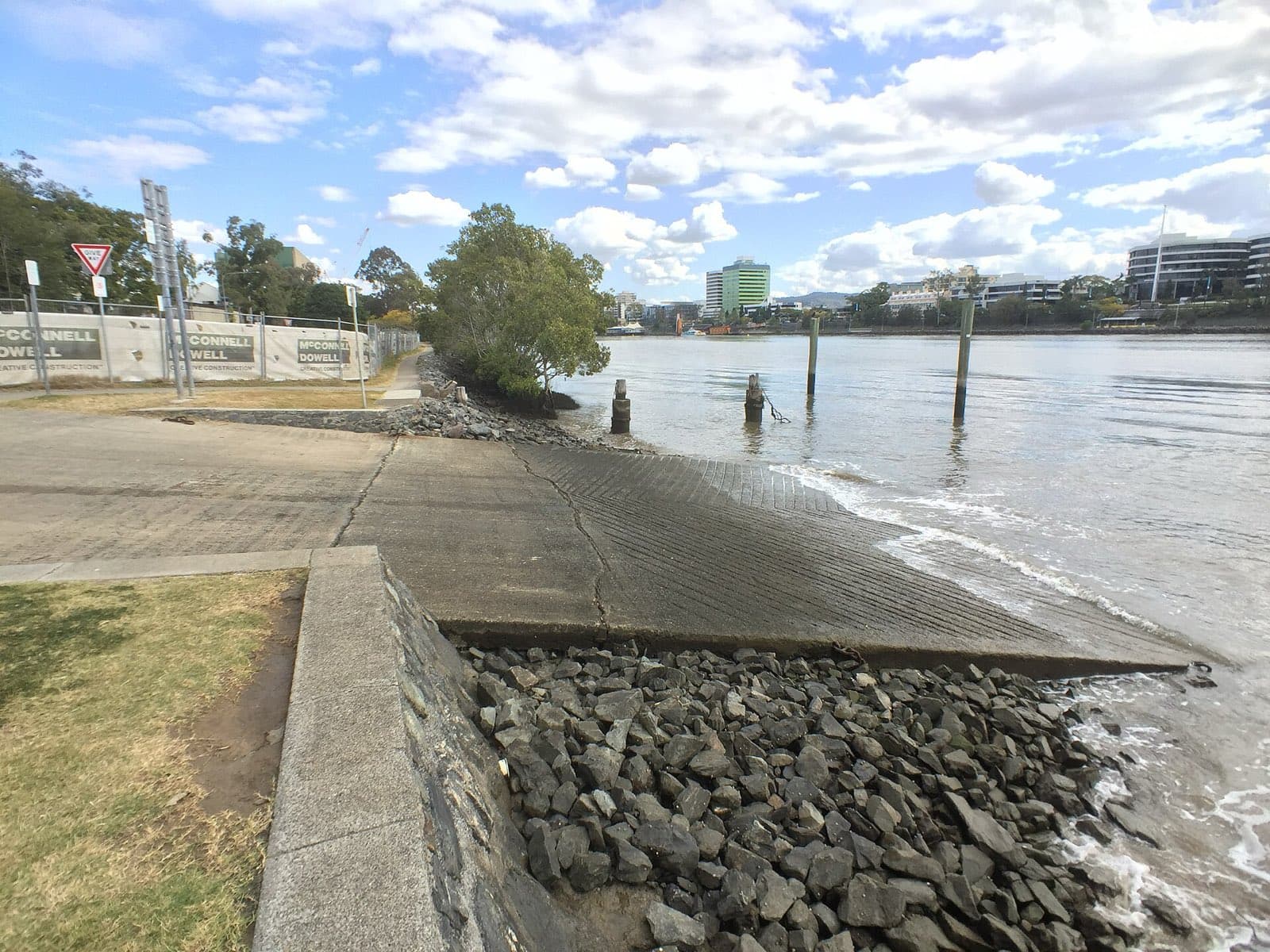
The Riverside Drive ramp at South Brisbane Riverside Lands Park – a double ramp with a pontoon on the south bank under the William Jolly Bridge, 15 bays, no facilities. The city-centre launch, with all the traffic that implies.

Gold Coast

Southport, Marine Parade & Broad Street

Harley Park on the Labrador foreshore – a twin ramp with a pontoon and small jetty, 62 bays, toilets and water, and the Broadwater cafés at your back. The parking goes very early, and the ramp is exposed to wind and current.

Gold Coast

Southport, Marine Pde & Welch Street

The three-lane ramp at Anzac Park beside the Gold Coast Aquatic Centre, at the southern end of Broadwater Parklands – toilets, water and 29 bays, but tide-limited over the flats. The big four-lane ramp is at the northern end of the same park.

Gold Coast

Southport, North Street

The Broadwater Parklands ramp – two double-width launching bays, three floating walkways and a landing pontoon at Fisherman's Lawn, with parking for about 90 rigs and the Seaway a short run away. The Gold Coast's go-to ramp, repaired and re-walkwayed in 2025.

Mackay

St Helens Beach, Ramp Road

The Carpet Snake Point ramp at St Helens Beach – a single lane and causeway rebuilt with a new breakwater in 2018, at the end of the road from Calen. Tide-limited, unformed parking, lit and camera-watched.

Broad Sound

St. Lawrence, Settlement Road

A single-lane creek ramp on the north bank of Bund Creek, six kilometres from the old port town of St Lawrence – tide-limited, unformed parking, and a long way from anywhere.

Broad Sound

Stanage Bay, Banksia Road

The two-lane ramp on Thirsty Sound at the end of a hundred kilometres of dirt – a fishing outpost with a store, fuel and a pub, and a ramp you use within about three hours of high water.

Mainland

Steiglitz, Cabbage Tree Point Road

Cabbage Tree Point at Steiglitz – three lanes at Charlie Hammel Park with toilets, a sandy beach, barbecues and a playground, and 18 bays plus the street. The launch for the southern bay islands, and a very busy one.

Mainland

Strathpine, Learmonth Street

The Learmonth Street ramp at Strathpine – a single lane into the South Pine River at Bob Bell Park behind the shopping centre, five bays and toilets. A quiet upriver launch for tinnies and kayaks.

Gold Coast

Surfers Paradise, Birt Avenue

Budds Beach on the Nerang River at Surfers Paradise – a small single ramp with a gentle slope onto a wide sandy beach, on-street parking only. Kayaks, canoes and jet skis; the sand covers the concrete.

Gold Coast

Surfers Paradise, Naples Avenue

The Isle of Capri ramp on the Nerang River – a single lane with six parks, no jetty, and a tidal current that runs hard past the ramp. Experienced users only.

Mainland

Tanah Merah, Tansey Drive

Tansey Park at Tanah Merah – a single lane on the north bank of the Logan with seven bays and no facilities, between Waterford and Carbrook. A quiet small-boat ramp on sheltered river.

Mainland

Thorneside, Helen Street

The Helen Street ramp at Thorneside – a single lane into Tingalpa Creek on Queens Esplanade, with toilets, water and 11 bays. Sheltered creek water, a short run to the bay past the Aquatic Paradise canals.

Mainland

Toorbul, First Avenue

The First Avenue ramp on the Toorbul Esplanade – a single lane onto the Pumicestone Passage, toilets and water, sharing 34 bays with the Freeman Road ramp. Tide-limited across the Toorbul flats.

Mainland

Toorbul, Freeman Road

Toorbul's main ramp near Freeman Road – two lanes with the floating walkway the state built in 2015, toilets, water and 34 shared bays on the Esplanade. All-tide in the register, with the Passage flats to cross.

Mainland

Toorbul, Moffat Esplanade

The Moffat Esplanade ramp on Ningi Creek, south of Toorbul – a single lane with toilets, water and lighting, unmarked parking, and low-tide restricted access up the creek.

Gold Coast

Upper Coomera, Gawler Place

A single ramp at John Siganto Park on the upper Coomera River – gravel beaches, eight parks, toilets, a dog park and a playground, in a peaceful spot at the top of the navigable river. Rocks in the calm water.

Victoria Point, Colburn Avenue ( North )

Mainland

Victoria Point, Colburn Avenue ( North )

The Colburn Avenue ramp on the northern side of the Victoria Point reserve – two lanes with a floating pontoon, toilets, water and 56 bays, and the passenger ferry to Coochiemudlo alongside. The pontoon is due for full replacement.

Victoria Point, Masters Avenue

Mainland

Victoria Point, Masters Avenue

The combined barge and boat ramp in the Masters Avenue harbour at Victoria Point – two lanes with a pontoon and toilets, 15 bays, and the Coochiemudlo vehicle barge sharing the water.

Mainland

Waterford, Albert Street

Larry Storey Park at Waterford – a single lane on the south bank of the Logan with toilets and seven bays, below the old Waterford bridge. A pleasant upriver ramp for small boats.

Wellington Point, Main Road

Mainland

Wellington Point, Main Road

Wellington Point's Main Road ramps – four lanes with a pontoon and jetty on the foreshore, toilets, water and 70 bays, and one of the most popular launches on the bay. Also one of the worst at low tide: the flats dry a long way out.

Proserpine

Wilson Beach, Wilson Beach Road

A rough single-lane ramp on the north bank of the Proserpine River near its mouth – small craft only, limited parking, cross-currents, and crocodiles.

Mainland

Woody Point, Hornibrook Esplanade

The Woody Point ramp at the end of Oxley Avenue near the sailing club – three lanes onto Bramble Bay with toilets, water, lighting and a picnic area, but only 13 bays and a three-tonne limit. Accessible on the upper tide.

Mainland

Wyaralong Dam

The Lake Wyaralong ramp at the Meebun day-use area – electric, sail and paddle craft only on Seqwater's newest dam, with toilets, picnic shelters and five bays. Bring your own drinking water.

Wynnum, Glenora Street

Mainland

Wynnum, Glenora Street

The Glenora Street ramp on Wynnum Creek – two lanes into a sheltered creek with good depth, toilets and water, and plenty of parking. Locals' pick for Mud Island and St Helena without the Manly queues.

Mainland

Yatala, Patterson Road

A single council ramp on the Albert River at Patterson Road, Yatala – no facilities, ten parks, and a reputation as the worst-rated ramp on the Gold Coast list. Don't trust the map app: it sends you to the wrong bank.