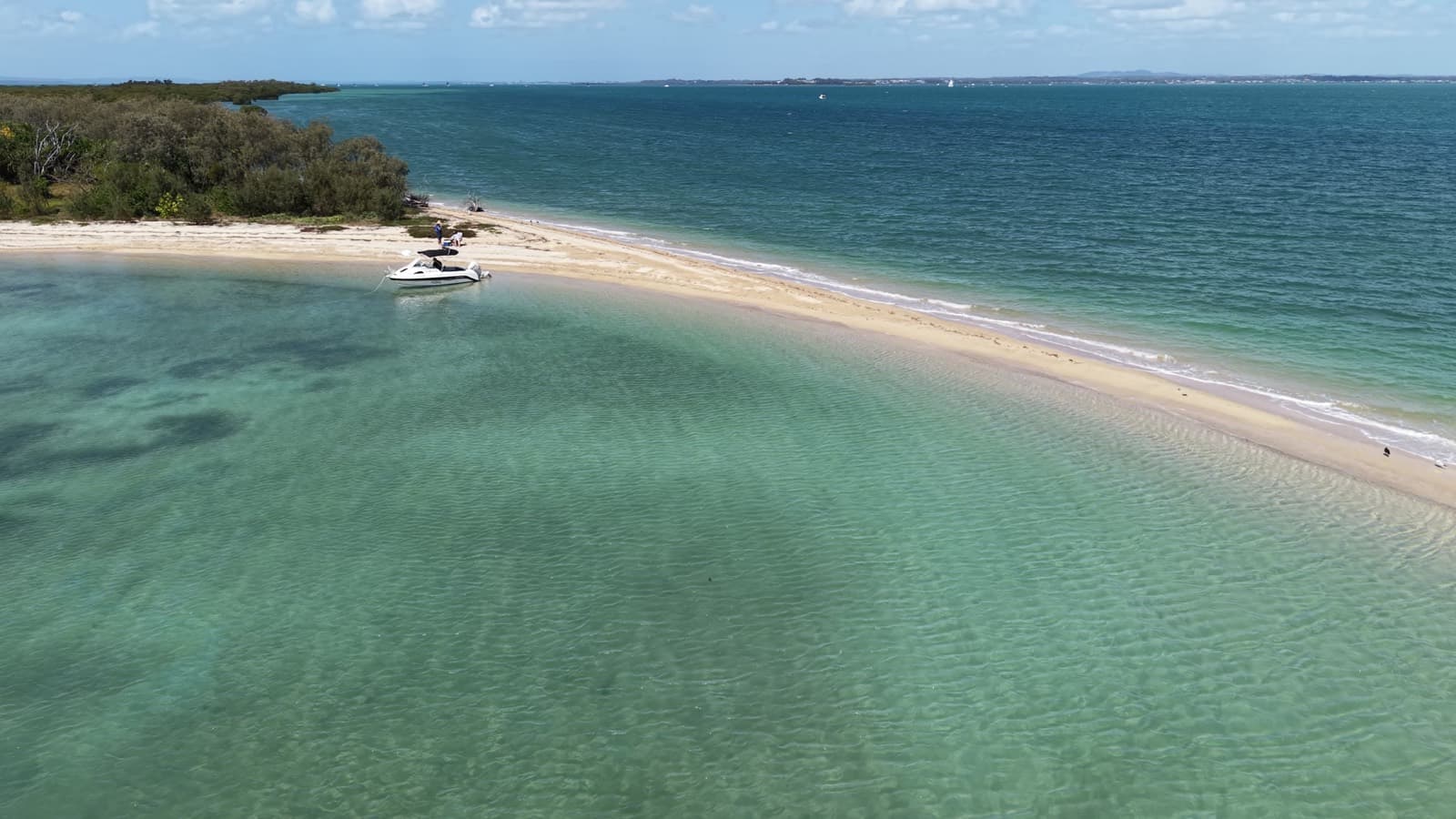
Green Island is the closest of the islands off Manly, which is exactly why it is the most visited. It is small, a bit over a kilometre each way, and almost all of it is mangrove, mud and thick scrub. The part you come for is the sand spit on the north-west corner: a curve of shell grit and white sand running out into the bay, with clear, shallow water on its sheltered side.
Underneath the mangroves it is an unusual bit of ground. The Moreton Bay Environmental Education Centre describes Green Island as the bay's only coral cay, built up over time by corals and algae, with mangroves, seagrass beds and coral reef packed into a very small area. From the air you can see the seagrass as dark patches through the clear water inside the spit.
Getting there
Launch from Manly Boat Harbour: the south ramp or the Fairlead Crescent ramp at the north end. Six knots applies throughout the harbour, and the entrance channel carries everything that lives in Manly, from yachts to ferries to trailer boats, so take it easy on the way out.
Once you are clear of the entrance, Green Island is the low green smudge to the north-east, about 5 km away. Lay a course for its north-west tip and the spit will show up as a white line in front of the mangroves. Banks surround the island, so come in slowly and read the water as you close the beach.
| Waypoint | Coordinates | |
|---|---|---|
| A | Manly Boat Harbour, south ramp | -27.460214, 153.189613 |
| B | Manly Boat Harbour, Fairlead Crescent ramp | -27.452573, 153.189016 |
| C | Harbour entrance (approximate) | -27.4512, 153.1928 |
| D | North bay - use in a southerly | -27.420014, 153.225988 |
| E | South beach - use in a northerly | -27.421015, 153.227129 |
| F | Mangroves - fishing spot | -27.420166, 153.227934 |
Where to anchor
The whole trick to Green Island is picking the right side of the spit.
- Wind from the south: tuck into the little bay on the north side of the sand bar (D).
- Wind from the north: the southern sand beach (E) is the one, and it is a great beach.
Either way, the bottom shelves gently onto shell grit and sand, and most boats simply nose in and run a line up the beach. The water on the protected side is clear enough to watch your anchor bite.
Stay on the spit. Past the sand, the rest of the island is basically inaccessible: soft mud along the edges and thick scrub and mangrove behind it. There is nothing to walk to.
Watch the tide. Banks surround the island. Arriving and leaving on the higher half of the tide makes the approach a lot less stressful, and keeps the boat floating if you have nosed in close.
Safety
Check your safety gear, your comms, the weather, the sea state, the tide and the current before you go. Maritime Safety Queensland has the resources for all of it.
Green Island sits inside the bay, well west of Peel, in Moreton Bay's smooth waters. Smooth and partially smooth waters carry different mandatory equipment:
Moreton Bay is shallow, and a short, sharp chop builds quickly when the wind gets up against the tide. Green Island is close enough that it is easy to underestimate the run home.
For peace of mind, get familiar with MRQ Manly, based in Manly (VHF 73, 07 3396 5911), or MRQ Raby Bay at Cleveland Point (VHF 73, 07 3821 2244) before you need either of them. Log on with one of them before you go. In an emergency, radio VHF 16 or call Triple Zero (000).
What is there
The spit for swimming and for doing nothing in particular. It is shell grit and sand, with lines of washed-up seagrass marking the high tide, a few weathered logs to lean on, and casuarinas and scrub along its back edge.
The mangroves at the island end of the bar stand right out in the water and are very popular for fishing.
The view is half the appeal. Look north-west and the cranes and stacks of the Port of Brisbane sit on the horizon. Look south-west and you are back across the water at Manly and Wynnum, with the ranges behind Brisbane beyond.
Things to do
Relax
The spit is made for a lazy beach day: nose the boat in, put a chair on the sand, and watch the traffic come and go from Manly. It does get busy on a good weekend, with boats lined up along the beach, families in the shallows and kids everywhere. Get there early and you can have it nearly to yourself, glassy and quiet.
Swimming
The water on the sheltered side of the spit is shallow, clear and sandy, and on a calm day the sun throws patterns across the bottom. Mind the props: there are always boats coming and going from the beach.
Fishing
The mangroves at -27.420166, 153.227934 are a very popular fishing spot. We do not fish much ourselves, so we will leave the species to the people who do.
Be aware of the zoning. The St Helena Island green zone (marine national park, no fishing) starts about 1.4 km north of Green Island's northern tip, at 27°24.470′S. Green Island itself sits outside it, but check the current Moreton Bay Marine Park zoning before you wet a line.
Beach stroll and photography
The stroll is short, out along the spit and back. Photography is where Green Island earns its keep. From the air, or from a high point on the boat, the curve of the spit against the clear water and the dark seagrass patches is about as good as Moreton Bay gets. Keep an eye out for turtles in the shallows at high tide.
Before you go
There are no facilities on Green Island: no toilet, no tap, no shade beyond the casuarinas at the back of the beach, and no rubbish collection. Carry water in, and carry everything else back out.